

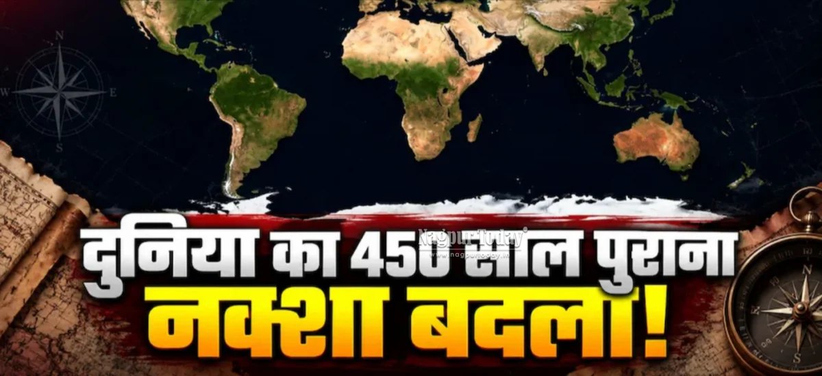
New Delhi: For centuries, people around the world have relied on maps that make some countries and continents appear much larger or smaller than they actually are. Now, a new international campaign called ‘Correct the Map’ is seeking to promote world maps that represent the relative size of land areas more accurately.
The debate centres on the Mercator Projection, a map projection created by Flemish cartographer and mathematician Gerardus Mercator in 1569. Although the projection revolutionised maritime navigation by preserving directions and angles, it significantly distorts the size of land masses, particularly those located closer to the North and South Poles.
The issue has gained fresh attention after a proposal was introduced at the United Nations General Assembly (UNGA) by the African Union and Togo. The proposal received the support of 164 countries, while six countries did not vote. The United States was the only country to vote against it.
Why does the Mercator map distort the world?

The Mercator Projection was originally designed primarily for navigation rather than for accurately representing the size of continents and countries.
In the projection, the Earth’s spherical surface is transformed onto a flat map while preserving local angles and directions. However, this causes areas near the poles to appear increasingly stretched.
The most commonly cited example is Greenland and Africa. Greenland covers approximately 2.16 million square kilometres, while Africa covers around 30 million square kilometres. In reality, Africa is roughly 14 times larger than Greenland. On a Mercator map, however, Greenland can appear almost comparable in size to Africa.
The same distortion affects several countries in northern Europe, North America and other high-latitude regions.
Why is Africa demanding a change?
African countries have long raised concerns that commonly used world maps can create a misleading perception of the relative size of continents.
The ‘Correct the Map’ initiative does not argue that the Mercator Projection is useless. Instead, it seeks greater use of equal-area projections, particularly in educational and general-purpose maps where comparing the actual size of countries and continents is important.
One such projection is the Equal Earth Projection, which aims to maintain the relative area of different parts of the world more accurately.
Togo has reportedly announced plans to replace Mercator-based maps in its schools by the end of 2026.
The African Union has also called on international organisations, educational institutions, publishers and digital platforms to increase the use of maps that provide a more accurate representation of land areas.
Which countries will look smaller or larger?
On equal-area maps, several regions that appear disproportionately large on Mercator maps will look smaller. These include:
Greenland
Canada
The United States
Alaska
Norway
Sweden
Finland
Iceland
The United Kingdom
Several European countries
At the same time, Africa, Brazil, Indonesia and several South American countries will appear considerably larger relative to their representation on a Mercator map.
India’s overall appearance and relative size would not change dramatically compared with the major distortions seen in high-latitude regions.
India supports the proposal — but with a warning
India supported the ‘Correct the Map’ proposal at the UN, but clarified that its support should not be interpreted as an endorsement of any particular map projection, including Equal Earth.
India’s position is that equal-area projections should be used more widely wherever accurate comparison of the size of countries and continents is important.
At the same time, India pointed out that no single map projection can be considered perfect for every purpose. Different projections are designed to preserve different properties, such as area, shape, distance or direction.
India also issued a separate warning regarding the depiction of its territories. External Affairs Ministry spokesperson Randhir Jaiswal said that any world map proposed or used by the United Nations must depict the Union Territories of Jammu and Kashmir and Ladakh in accordance with India’s official map.
India made it clear that any inaccurate or misleading depiction of its boundaries would not be acceptable.
Why did the US oppose it?
The United States was the only country to vote against the proposal.
The US described the initiative as an “ideological agenda” and argued that it could divert attention from more pressing issues concerning international peace, prosperity and relations.
The disagreement highlights an important point: the debate is not simply about replacing one world map with another, but about how maps should be used for different purposes.
Will all world maps now change?
No.
The UN initiative does not mean that every map in the world will be replaced with a single new projection. The objective is to encourage greater use of equal-area projections in situations where accurate representation of land area matters.
The Mercator Projection will continue to have a role in navigation because of its ability to preserve directions and angles.
For example, digital mapping systems can also use projections derived from the Mercator approach because of their practical advantages. Meanwhile, a globe provides a much more realistic visual representation of the relative size and shape of continents.
Is there a ‘perfect’ world map?
There is no single perfect flat world map.
Because the Earth is spherical, transferring its surface onto a flat sheet inevitably creates some form of distortion. One projection may preserve area better, another may preserve shape, while another may prioritise distance or direction.
That is why the real issue behind the ‘Correct the Map’ campaign is not simply whether the Mercator map is “wrong”. Rather, it is about using the right map projection for the right purpose.
For navigation, Mercator remains highly useful. But for classrooms and general maps where people compare the size of continents, equal-area projections can provide a more accurate picture of the world.